Sensors and Platforms Systems Group
The Sensors and Platform Group, led by Prof. Craig Underwood, has the remit of developing the instruments, systems and data processing techniques needed to investigate the Earth and other planetary environments from space.
Current research programmes
- The analysis of the space radiation environment (space weather) and its effects
- Development of miniature ionizing radiation monitors
- UV-optical, thermal-IR and radar imaging for atmospheric, oceanographic, ice-monitoring and land-use applications
- Machine vision and optical navigation sensor development (CMOS cameras)
- Radiometric calibration of instruments
- Nano- and pico-satellite technologies and micro-air-vehicles for planetary exploration.
Space weather environment and effects monitoring
Commercial-off-the shelf (COTS)-based microelectronics are playing an increasing role in spacecraft systems design. However, flight experience has shown that such devices are particularly susceptible to the deleterious effects of the severe ionising radiation environment encountered in Earth-orbit. The primary objective of this research programme is to investigate single-event-effect and total-ionising-dose phenomena as they occur in state-of-the-art COTS technologies flown on-board Surrey's spacecraft, and to evaluate mitigation and protection strategies. To aid this process, simultaneous measurements of the ionising radiation environment experienced by these satellites are made through various ionising radiation monitoring instruments developed by the group, e.g. CEDEX - the cosmic-ray energy deposition eXperiment.
Current research is directed towards minimising the size of these instruments down to "credit-card" size so as to provide a means for routinely monitoring the radiation environment inside operational spacecraft. In related projects, work is progressing in analysing radiation effects in the advanced micro-electronic data handling systems and in studying the anisotropy in the proton flux in the South Atlantic anomaly.
The Planetary Environments Group also supports SSTL with help, advice and practical ground-based testing of components in the context of high-energy particle interactions with spacecraft systems. Currently, this is being done in the context of missions planned for medium and high-Earth orbit.
Global total ozone mapping and UV imaging
The Planetary Environments Group, in conjunction with SSTL and the Chilean Air Force (FACH), designed and developed a miniaturised ozone layer monitoring experiment (OLME), which was flown on-board the 50 kg FASAT-Bravo, launched in July 1998 into an 820 km altitude Sun-synchronous orbit.
The purpose of the OLME is to monitor the distribution and concentration of ozone in the Earth's atmosphere at a small fraction of the cost of conventional instruments. The experiment comprises two instruments: the ozone ultraviolet backscatter imager (OUBI) - a dual dye-coated CCD-based system, capable of taking "snap-shots" of the UV backscattered from the atmosphere at a wavelength of 313 and 380 nm with a ground-resolution of ~3 km, and the ozone mapping detector (OMAD) - a four-channel UV-enhanced photodiode-based radiometer operating at 289, 313, 334 and 380 nm wavelengths with a ground resolution of ~150 km.
The group has been using the OMAD instrument to generate daily global "maps". These maps clearly show the formation and extent of the ozone "hole" which appeared in the Antarctic spring of 1998 and 1999. OMAD's "UV-albedo" maps show the global extent of cloud belts and ice sheets.
Research this year has focussed on correlating the OMAD data set with NASA's total ozone mapping spectrometer (TOMS) data and searching for other "signatures" in the data including looking for atmospheric pollution.
Thermal IR imaging
The Planetary Environments Group is now developing a small, un-cooled, solid-state thermal imaging system for future spacecraft. The instrument uses up to three thermal IR bands to provide meteorological data on land, sea and cloud-top temperatures, sea-surface temperatures and localised "hot-spots", such as forest fires and volcanic eruptions.
Earth observation image calibration and radiometry
The Planetary Environments Group provides research support for SSTL's Earth observation imaging missions. Currently, the group is aiding SSTL in the optical and radiometric calibration of the multispectral cameras, which are flown on the disaster monitoring constellation spacecraft. The first of these, ALSAT-1, was successfully launched in November 2002, and is producing stunningly detailed very wide swath-width images.
CMOS camera technology and machine vision
The Planetary Environments Group pioneered the use of miniature CMOS video cameras in space with the launch of such a camera on-board the 1998 Thai-Paht micro-satellite mission. This mission paved the way for the use of such cameras for remote-inspection nano-satellites - a concept which the group has been developing since 1995 - culminating in the launch of the first such mission, SNAP-1, on 28 June 2000.
One of the principal objectives of the SNAP-1 mission was to demonstrate the ability of nano-satellites to act as automatic "eyes-in-the-sky" to allow astronauts to examine the outside of their space vehicles for damage, etc. To test this concept, SNAP's four ultra-miniature CMOS cameras were used to provide "video telemetry" on its own deployment, as well as to image the deployment of the Tsinghua-1. The whole 60-second imaging sequence was controlled automatically by SNAP's Machine Vision System. The very first picture, taken just two seconds after deployment, shows the Russian Nadezhda satellite which had carried 6.5 kg SNAP-1 into orbit, and a few seconds later, the cameras showed the Tsinghua-1 deploying into space.
The group is currently working on the next generation of CMOS camera based systems for attitude sensing, visual inspection, optical navigation and multi-camera/multi-spectral Earth observation.
The first of these instruments is an eight-channel radiometric imaging sensor, which has been developed as part of the NigeriaSat programme. This is aimed at such applications as ocean colour sensing, land use monitoring and mineral prospecting. Work is also in progress on a single-camera passive optical navigation/rendezvous system designed for a remote inspector satellite.
Bi-static synthetic aperture radar (SAR) imaging
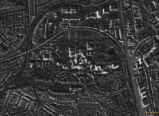
The SERS group have developed a novel method by which two s fly in a specific formation to accomplish a SAR imaging mission. Such missions normally require too much volume and power to be compatible with a platform. However, we have found a near-nadir viewing bi-static arrangement which cuts the power requirement down to ~100W and will fit into a standard SSTL enhanced bus.
The transmitting satellite will be the "master", with the receiver satellite "slaved" off it. The satellites, together, view a swath of 30 km, from 700 km altitude, with a ground sample resolution of 30-meters.
Work is in progress in designing the radar transmitter and receiver and the synchronization system needed to operate these over separated platforms.
Nano-/pico-satellite technology
After the success of the SNAP-1 nano-satellite launched in June 2000, the Planetary Environments Group is now developing a pico-satellite (i.e. a sub-1 kg satellite) called PALMSAT.
PALMSAT is an ultra low-cost satellite suitable for student-based research and project activities. The satellite will carry highly integrated "credit-card" sized systems which should enable it to carry out a remote inspection mission - similar to SNAP-1.
Mars aerobot
The group is developing an autonomous micro-air-vehicle: MASSIVA (Mars surface sample imaging VTOL aircraft) which is designed to explore the surface of Mars.