Evaluating the capabilities of high resolution, space borne MWIR data for maritime vessel detection using synthetic data
Start date
01 October 2020End date
31 March 2021Overview
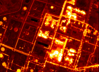
This project flew a mid-wave infrared (MWIR) camera on an airplane to collect data that simulates the data that would be captured from a space-based sensor. This dataset was then used to validate the commercial applications that Satellite Vu is developing to support their customers, focusing on the advantages MWIR might have over Synthetic Aperture Radar (SAR) data for small boat detection.
The airborne campaign covered a range of locations and facilities of particular interest for which MWIR imagery can provide better insights than existing sources. Subsequent processing and validation of the acquired imagery was performed in order to show potential commercial maritime applications using a range of processing techniques.
Funding amount
£95,000
Funder
SPRINT and Satellite VU
Team
Principal investigator

Dr Raffaella Guida
University of Surrey
See profileLead researcher

Dr Maximilian Rodger
University of Surrey
See profileOutputs
M.B.Rodger, R.Guida, “Comparison of High-Resolution Airborne MWIR Data with SAR and AIS for Ship Detection”, International Geoscience and Remote Sensing Symposium ’21, Brussels (Belgium), 2021.
Research themes
Find out more about our research at Surrey:
