
Space 4 Sustainability
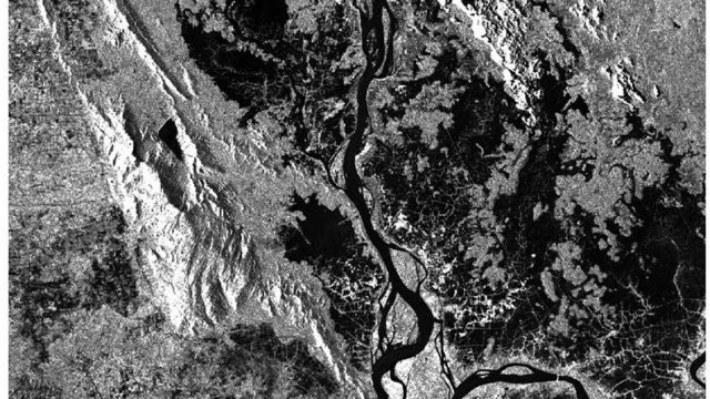
At Surrey, we harness the power of satellites and Earth observation to tackle real-world challenges — from monitoring biodiversity and climate change to improving education and clean water access. Our research turns space data into solutions that transform lives and support the UN Sustainable Development Goals.
Meeting sustainability goals using Earth observation
The UN’s Sustainable Development Goals (SDGs) aim to eradicate poverty, protect the environment, and promote global well-being by 2030. A significant challenge in achieving these goals is the availability of high-quality, comprehensive data to track progress across the 231 indicators. Traditional data sources, such as national censuses and surveys, are often insufficient, particularly in developing countries where resources for data collection are limited. EO data offers a transformative solution by providing cost-effective, scalable, and timely insights into environmental and socio-economic indicators. Our research highlights that EO can support 108 SDG indicators, helping to bridge data gaps and enhance monitoring efforts, particularly in regions facing data scarcity. Bringing together knowledge within the Centre for Environment and Sustainability and Surrey Space Centre (which pioneered the low-cost small satellite industry), Space 4 Sustainability is aimed at optimising the use of EO to provide much-needed data for a range of applications.
Find out about the Centre for Environment and Sustainability's research with the National Physical Laboratory on ‘Seeing Sustainability from Space’.
Read about the analytical framework developed by the Centre to translate EO data into SDG indicators.
Dr Ana Andries presents the Space4Nature project at COP16 – United Nations Convention to Combat Desertification, highlighting how Earth observation supports biodiversity.
Projects
Our recent and active projects demonstrate the critical role Earth observation can play in helping to achieve environment and sustainability goals by addressing the UN Sustainable Development Goal indicators.
Conservation and Rural Enterprise (CARE) initiative
The CARE initiative addresses rural poverty by linking eco-lodges, small enterprises, and community-led projects to sustainable income generation.

Potential of using night-time light to proxy social indicators for sustainable development
This project investigates how satellite-derived night-time light (NTL) data can serve as a proxy for monitoring poverty, inequality, and access to services at local scales.
Leveraging very high-resolution satellite data and machine learning for schistosomiasis risk mapping
Funded by the EPSRC, this PhD project investigates how very high-resolution satellite imagery and machine learning can improve disease risk mapping for schistosomiasis.

MAESMA Initiative: space-based monitoring of air pollution in the Middle East and Africa
As part of the MAESMA-GEO Observatory Project – an international effort to develop satellite-based monitoring of air pollution across the Middle East and Africa – researchers at the University of Surrey have contributed through two projects. One explored how satellite data can inform air quality policy and support community-led monitoring using surveys and interviews, while the other analysed the climate and health impacts of tropospheric pollutants using existing satellite data.

Assessing overcrowding in Nigerian schools
A study aimed at identifying overcrowding in rural primary schools in Nigeria, with the objective of improving quality of education.
Meet the team
For further information, contact Ana Andries.

Dr Ana Andries
Lecturer in Remote Sensing and GIS

Professor Stephen Morse
Chair in Systems Analysis for Sustainability

Dr Raffaella Guida
Reader in Satellite Remote Sensing

Professor Jim Lynch
Distinguished Professor of Life Sciences Emeritus

Dr Belen Marti-Cardona
Associate Professor (Reader) in Earth Observation and Hydrology

Professor Richard Murphy
Emeritus Professor of Life Cycle Assessment

